Dedicated to capturing Harlow, in pictures...

Monday 21 December 2020

Where it all began...

 1949 - and construction begins on the first 120 permanent houses of the New Town we now know as Harlow. Chippingfield - to the south of the original village of Harlow - now Old Harlow. 


The first houses were tenanted by employees of the Development Corporation and many of the tradesmen brought in to construct the new town, and their families. It must have been very strange for their wives in particular - having come from places like Walthamstow and a Tottenham in London, areas which would at the time have had an infrastructure that they knew and house styles that were familiar - in the new town neither of these things applied.


Not only were shops more distant, and initially fewer than the new residents were used to. The houses too - the traditional London terrace build of the time would have seen a sitting room at the front, looking into the street, with living/dining room behind and the kitchen behind that. The toilet would likely have been either directly adjoining the kitchen, via the back door, or in a building across the yard. The designers of the new houses favoured kitchens at the front, theoretically allowing the “modern housewife” to feel like she was part of the community even whilst going about her day. In some cases the interior layout would have also been far more open plan than these families were used to also. 


Chippingfield today is a pleasant area, surprisingly quiet considering it’s proximity to Gilden Way. Many of the original features of the estate remain - the “open fronts” are far more universally maintained than in many areas of the town. The biggest change is that there are of course now cars everywhere - clogging the streets in a way that the designers could probably not have anticipated! 

Tuesday 15 December 2020

Parking solutions...


 I mentioned in the post about Bishopsfield that when the properties there were built, the expectation was that every property having an allocated underground garage would cover all the parking requirements for the development. Now of course with so many properties having more than one vehicle, the parking spills onto the surrounding streets too. 

Bishopsfield is not the only area to have been given this sort of underground parking either - some of the tower blocks have a similar arrangement- including Nichols Tower - pictured above. 

Now, the underground garages are closed off and disused - and mostly full of rubbish


The garages are quite narrow, and even with working lighting (you can’t tell from the photos but it was very dark inside) I’m none too sure I would fancy having to park my car in the very back of that area. I suspect this is the reason why they are no longer used. I’m sure when the town plan was written it seemed inconceivable that it would be possible for the majority of households to have a car, and also that in a town like Harlow, that so many people would consider they needed one. 

Thursday 10 December 2020

Passmores...


Passmores Academy has some of the most striking architecture of the schools in the town, but did you know it was originally in an entirely different location? 

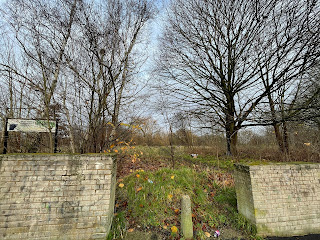
Formerly situated further across to the West on Tendring Road, the site is now flattened and half is lying empty - all that remains is the old concrete foundations, some light standards..


...and the entrance, plus some fencing... 


 There is a “West Essex Community Education Service” sign lurking over to the left hand side there too. The other side of the site is in the process of having the new Sir Frederick Gibberd College built on it - currently looking as though it might just top Passmores on the architecture front. 

The original location of course makes sense of the name of course, being actually in the Passmores area! 

Thursday 3 December 2020

Bishopsfield

 In 1961 the Harlow Development Corporation held a competition open to all architects for the design of a housing area in the new town - they were looking for something unusual, and different, with the brief being “to solve old problems in a new way” and the design put forward by 24 year old Michael Neylan appeared to fit the idea perfectly. 


Featuring 256 dwellings - a mix of maisonettes and houses, the development is known as “The Kasbah” locally, and even now looks very different to almost anything else in the town. 


Bishopsfield consists of a horseshoe shaped development with alleyways radiating off it and green spaces between each section. 


Pedestrian walkways are vehicle free - with access being provided via a large open platform leading to a wide walkway accessed via either ramps or stairs. Parking was originally provided via garages tucked away beneath the blocks, but has now unsurprisingly spilled over into the street also. 


Beyond the 5 main blocks forming the horseshoe, the majority of the properties are built on a “back-to-back” pattern, with an L shaped design surrounding a courtyard style garden giving a great deal of privacy - the aim here was to achieve an almost Mediterranean feel. 


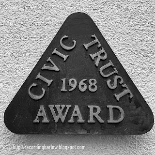
Bishopsfield was awarded a Civic Trust Award in 1968, and Housing Design Award a year later. 


Tuesday 1 December 2020

Sculpture trail... (1)

During the first lockdown, we began the long overdue mission of finding and photographing as many as possible of the town’s many Sculptures. Although we’ve looked at a few of them before, and there is even an earlier post on here about Harlow’s Sculpture Town Status we had never actually attempted to walk the trail. 

We ticked them off on groups - taking an area at a time, walking to it, finding all the sculptures in that area, then moving on to the next area the next time we went out with this particular task in mind. For the purpose of these posts through, I’ll post in trail order. 

No. 1 - Cat - unable to access as inside the Civic Centre.

No. 2 - Well Head - Museum Gardens - finally got to this one last weekend...


No. 3 - Stone seat - Museum Gardens as above. 


No. 4 - Butterfly - Newstead Way, Fifth Avenue Development


No. 5 - Sophrosyne - The Chase, Newhall


No. 6 - Madonna & Child - unable to access - inside St Paul’s Church. 

No. 7 - Organic Farm - Fifth Avenue Development but we were unable to locate.

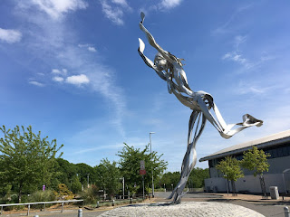
No. 8 - Energise - Harlow Leisurezone


No. 9 - Soldier Bending a Bow - unable to access - inside The Playhouse Theatre

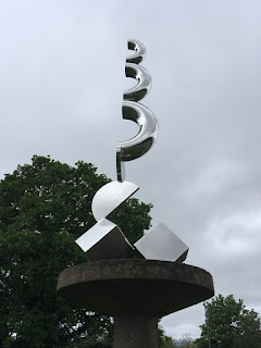
No. 10 - Echo - Southern Way

To be continued... 

(All photos copyright www.photozone72.org.uk)

Saturday 28 November 2020

Harlow Museum Gardens (2)

 A bright spot in the Covid/Lockdown darkness has been the opening, three days a week, of the Museum walled gardens to the public. A beautiful place to visit at any time, it’s somehow all the more special at the moment - when there are less options available to us. I posted about the gardens previously - you can see that post HERE


In that post I referred to the “unusual fruits garden” with its medlars and figs, among other things - the photograph above shows the figs are still prolific, and the same is true of the medlar tree - or “trees” I should say as we spotted another one on this visit.


The gardens currently have one staff gardener, and a handful of volunteers - numbers are being limited by Covid restrictions of course - and they are doing a wonderful job of keeping on top of the work required by gardens of this size. The big job currently is the stripping back of ivy around the tall red brick walls ahead of a structural survey which is needed. 


The 17th Century garden is looking very neat and tidy - look carefully and you can spot one of the Sculpture Trail works in the middle - there are 6 scattered around the gardens, look out for those getting a separate post of their own. 


You can compare this photo with the one in the earlier post - it’s taken from the same viewpoint up on the platform at the end. The planting has filled out in those closest beds in the last 12 years! 

Friday 27 November 2020

To the river...

 Alongside Harlow’s many green spaces, green wedges and of course the Town Park, we are also bordered along the northern edge by the River Stort - from Harlow Mill to the east through to Parndon Mill on the western side. 


The river is popular with runners, walkers, anglers, birdwatchers and even cyclists - generally managing to amiably share the towpath which runs on the north bank as far as Terling’s Park before switching to the opposite side to Burntmill Lane where it crosses back again as it leaves the town. 


Always beautiful - but never more so on a crisp, misty autumn morning with a frost edging everything  in  silver, and the sun just trying to punch through. 


As the “Navigation” designation suggests, this is a river still used regularly by boaters - both the traditional narrowboats and more modern motorised vessels - this morning I saw just one solitary narrow boat, but in a sunny summers day there is a regular stream of traffic using the waterway. 


Wildlife is plentiful - Kingfishers, Warblers, Whitethroats, and Blackcaps can all be found in and around the overhanging vegetation, ducks and rails on the water and various birds of prey and the ever present gulls overhead. Also present are water voles - now quite endangered and always a delight to spot. 


Next time you find yourself fancying a walk somewhere within the town, head downhill and explore the river - as well as the towpath there is also a footpath along a fair amount of the opposite bank accessible from the car park on River Way. The river and its surrounding meadows are also linked with the Town Park via the zigzag bridge, and is just a short stroll from the railway at either end of the town too. 

Tuesday 24 November 2020

Word of mouth...

Moot House & “Chiron” sculpture

This morning I got the opportunity via a chance encounter to hear some word of mouth local history - so often the best way of learning about a subject. Ironically while I was taking photos for the blog, a chap kindly stopped to avoid walking across in front of me, and we got chatting when I thanked him and explained what I was doing (presumably not too many people take photos of Moot a house at The Stow as he was a little surprised to see what I was doing I think). 

The gentleman concerned moved to the town with his family in 1956, and has lived here ever since - so effectively he’s seen the New Town almost from the start. In that time he said he’s seen a lot of change, and not all of it good! 

I asked him about the common rooms and commented that I was curious about the variation in sizes. He agreed - while some were big enough that dances could be held in them, others like Blackbush Spring are tiny! He told me of the time when while working with his father in a wedding catering business they were booked to cater a reception in the Ladyshot Common Room - one of the few with an upstairs. This particular ‘upstairs’ had a sprung wooden floor which turned out to be surprisingly bouncy - while the rest of the food was being set up as the guests arrived, the floor bounced a little too much sending the wedding cake shooting off to one side all over the table! 

Those in the Mark Hall South area will be familiar with Latton Farm and its resident herd of cows. When my friend of this morning was a lad he worked for a while at the farm, with one of his responsibilities being taking the cows from their barn to the fields further along Latton Street, and occasionally slightly further afield, to the other side of what was then the A11 - now the rather busier A414. He recalled one particular occasion when several of the cows decided to “go rogue” and stroll away from the rest of the herd while part way across - 4 cars were delayed and had to wait while he rounded up the strays, he laughed “imagine what it would be like now - the police would be called and everything!”

Other snippets of history he recounted to me include the time somebody decided to build houses on Ash Tree field, ignoring the fact that it was part of the flood plain. They pressed on in spite of many locals telling them it was a poor idea right until the point where a bulldozer was driven into the field - and promptly sank! Also, the amusement when upon the decision being taken to build a play scheme in the Little Parndon neighbourhood where he grew up, it was decided that a local pond would have to be filled in because it was “too dangerous” to leave it there - he said that he had spent countless hours each summer with friends lying along the branch of a willow that overhung that pond - and nobody ever drowned!

A wonderful chance to hear some great stories about Harlow over the last 60 years! 

Monday 23 November 2020

Autumn colour and going car-free...

We are very fortunate that "New" Harlow was built around a network of roads that were already there - Latton street, Netteswell Road, Latton Common Road and many others were all closed off to motor vehicles once the New Town was built around them and are now available for safe cycling and walking, meaning that those of us who prefer to leave the car at home where possible have an easy "off grid" way of getting from A to B across the town. I can make my way from home in Mark Hall to the Town Centre barely touching a "normal" road, and to the station in the same way thanks to the Town Park.


Of course at this time of year the pleasure is all the greater as another of the Town Planner's achievements comes into its own with the fantastic colours from all the planting. There surely can’t be a better time for a stroll around Harlow than autumn, when even on a fairly overcast day there is still a stunning array of colour. 

During the first Covid lockdown we did a lot of walking around the old roads - indeed on a few occasions it became a bit of a challenge to see how far we could go using as few roads also used by motor vehicles as possible - and it was surprising how easy it was. I even did one 5 mile run almost entirely on old roads, tracks and footpaths, with only a couple of short sections where I was sharing my space with cars. 


Those who don’t know Harlow often voice the opinion that it’s a real concrete jungle - but mostly nothing could be further from the truth - we all have an abundance of green space right on our doorsteps, and the majority of households have open countryside within a reasonably accessible distance, too. Precisely what Sir Frederick Gibberd intended with his plans for our town! 

Wednesday 18 November 2020

Common as..

 One of the key tenets in the planning of the new town was a focus on community - for there to be both larger community centres such as Moot House and Tye Green Community Centre, and also smaller neighbourhood “common rooms” where more local get togethers such as coffee mornings or playgroups might take place without people having to travel a huge distance from home. My map from 1964 shows 12 of these dotted around the town and although some have been demolished and built over, many do still remain. 


Churchfields Common Room 

Some of the remaining rooms are still used for various “community” activities - the one above houses a martial arts club now, for example. 

Probably my favourite of those I have seen so far is this rather cute “prefab” style room at Glebelands - numbered 1 on my map and I suspect it may have been the first to be built. I’m not sure whether this one is still in regular use but it’s certainly beautifully cared for! 


Glebelands Common Room 

From the common rooms I have tracked down currently, one notable thing is how different they all are. From the tiny Glebelands one, we move on to the Ladyshot offering - rather larger and grander - and also these days with rather less windows than it was originally built with! (see here: HERE for how it looked when it was first built). 

Ladyshot Common Room with Ralph Brown sculpture

Now the long term home of the Harlow Amateur Boxing club, this is one venue that is in use pretty much 7 days a week, still, a albeit probably not for anything that Sir Frederick Gibberd might have expected! 


Halling Hill Common Room

Finally for this post, a style of building that seems almost more suited to somewhere on the Norfolk coast than a new town in Essex - this granite facing is commonly seen elsewhere in East Anglia. This one looks a little more neglected than most of the others I have seen so far - obviously damp and with quite an air of neglect. I wasn’t able to ascertain whether it is still used at all, or not. 

I also tried to track down one more of the Common rooms before posting this - my map shows one formerly in place at Pipers Hatch for Long Ley - however this appears to have been demolished when the new health centre at Sydenham House was built. 


Sunday 15 November 2020

Past and present...


Source: Harlow.gov.U.K. 

Source: Round about Harlow 

The Stow was Harlow New Town’s first “Neighbourhood centre” - areas designed into the town plan to ensure that each neighbourhood had shops sufficient to suit a family’s needs for day to day living, a Pub, post office, chemist, library and a bank. There was also a Health Centre close by providing in most cases Doctors and Dentists services.  Serving the town’s first residential areas of Mark Hall North & South and Netteswell, initially it was the “town centre” for those moving in, but as the town began to increase in size focus switched to The High and Stone Cross. 


A look through the list of shops at The Stow soon after it was built reveals some familiar names - Boots the Chemist has been there since the early days, for example, as has Dorringtons Bakers. “Big names” of the time include Freeman, Hardy & Willis (footwear), Sketchley (dry cleaners) & W.H.Smith & Sons (newsagents). In 1964 The Stow had 3 different butchers, 2 greengrocers, 2 bakers and no fewer than 7 general grocers - just imagine that, these days! This is a time that predates people’s heavy reliance on supermarkets as we know them now of course - indeed the closest Harlow had at the time were the Co-Operative society stores - still in evidence in some of the other neighbourhood centres although long gone from The Stow.

Source: Information board within The Stow today

Originally the area was not pedestrianised as the photographs above show - perhaps strange considering that one of the main features of the town plan for The High was the complete lack of cars within the central area. 
Source: www.photozone72.org.uk 

Now, things look rather different. No cars, but instead trees and flower beds which oddly serve to make the space feel smaller than the 1950’s appearance above would suggest. Boots and Dorringtons remain, but we have no butchers, no greengrocers, no bank and a library which is open so rarely as to make it sadly impractical for use by many working locals.  Two convenience stores are used mainly for the odd items that people failed to pick up on their main shopping trips - with Aldi just around the corner being the prime location for many of those. 


I plan to return to some form of regular posting here - in the first instance with some more of these “past & present” posts recreating old photos with views taken from similar locations today, to show how much things have changed - or not. Please do pop back and check for new posts, and thank you for reading.